PilotPrepPilotPrep
PPL Air Navigation and Flight Planning

PPL Air Navigation and Flight Planning

Product information

What you'll get

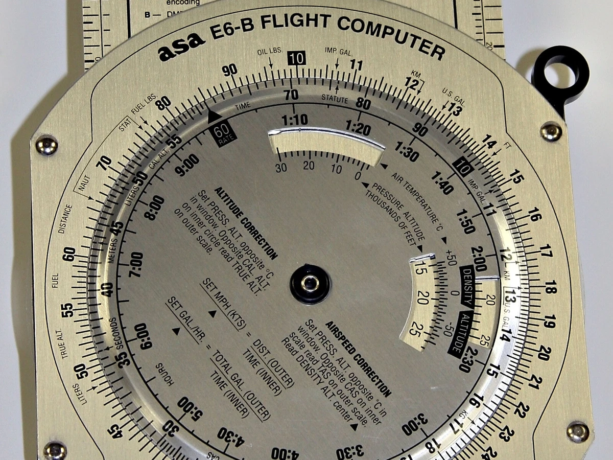
  • Flight computer and chart work taught step by step
  • Exam-style quizzes
  • Complete VFR cross-country planning walkthroughs
  • Interactive elements

This course is intended solely for the purchaser and may not be copied, printed, redistributed, or shared with others. Read full licence

Description

Navigation is the PPL subject where the most marks are lost to arithmetic and chart handling rather than to any lack of understanding, and it is also the subject you will use on every cross-country flight for the rest of your flying life. This course is built to make the mechanics second nature, so that in the air your attention stays on flying the aeroplane.

You start with the shape of the earth, direction, distance and speed, and how a position is referenced with latitude and longitude or a bearing and distance. From there it moves to altimetry, time and the twilight rules that decide when you must be on the ground, and then into the visual navigation chart itself: its projection, scale, symbology and the relief depiction you will be reading in the cockpit. The computational core follows, taught step by step on the flight computer: wind components, the triangle of velocities, the 1 in 60 rule and the in-flight revisions of heading, groundspeed and estimate that keep a diversion under control.

The final chapters bring it together into a complete VFR cross-country: route selection, chart and flight-log preparation, fuel planning with the required reserves, and the techniques of pilot navigation in the air. Every topic maps to the NZ CAA PPL Navigation and Flight Planning syllabus and the ASPEQ examination, with worked examples and exam-style questions throughout. This course is in production now. Use the Contact Us button and we will let you know the moment it opens.

Pre-requisites

  • None

Course Overview

  • 1. Chapter 1: Earth and Reference Frames

  • 2. Introduction

  • 3. The Earth's Shape

  • 4. The Earth's Axis and Rotation

  • 5. Geographic and Magnetic Poles

  • 6. The Equator

  • 7. Parallels of Latitude

  • 8. Meridians of Longitude

  • 9. The Greenwich Prime Meridian

  • 10. Reading Positions in Latitude and Longitude

  • 11. Summary

  • 12. Summary

  • 13. Chapter 1 Creation: Completion Summary

  • 14. Chapter 1: Visual Resources Summary

  • 1. Chapter 2: Direction Systems and Magnetism

  • 2. Introduction

  • 3. The 360-Degree Method

  • 4. The Earth's Magnetic Field

  • 5. True, Magnetic, and Compass North

  • 6. Cardinal and Intercardinal Directions

  • 7. Headings, Tracks, and Bearings

  • 8. Magnetic Variation, Dip, and Isogonals

  • 9. Converting Between True, Magnetic, and Compass Directions

  • 10. Relative Bearings and the Clock Method

  • 11. Chart Bearings and Distances: Cautions and Limits

  • 12. Summary

  • 13. Chapter 2 Creation: Completion Summary

  • 14. Chapter 2: Visual Resources Summary

  • 1. Chapter 3: Chart Basics and Distance

  • 2. Introduction

  • 3. Aviation Distance Units

  • 4. Converting Distance Units

  • 5. Measuring Distance on Charts

  • 6. Chart Scale

  • 7. New Zealand Aeronautical and Aerodrome Charts

  • 8. Summary

  • 9. Chapter 3 Creation: Completion Summary

  • 10. Chapter 3: Visual Resources Summary

  • 1. Chapter 4: Chart Symbology and Terrain

  • 2. Introduction

  • 3. Chart Features and Symbols

  • 4. Relief Depiction on Charts

  • 5. Aerodrome Charts and AIP NZ Volume 4

  • 6. Summary

  • 7. Chapter 4: Chart Symbology and Terrain - Highlights

  • 8. Chapter 4 Creation: Completion Summary

  • 9. Chapter 4: Visual Resources Summary

  • 1. Chapter 5: Position, Fixes & References

  • 2. Introduction

  • 3. Fixes, Dead Reckoning Positions, and Position Lines

  • 4. Position Reference Methods

  • 5. Deriving Chart Tracks and Bearings Safely

  • 6. Summary

  • 7. Chapter 5 Creation: Completion Summary

  • 8. Chapter 5: Visual Resources Summary

  • 1. Chapter 6: Speed, Velocity, and Airspeeds

  • 2. Introduction

  • 3. Airspeed Types

  • 4. Speed Versus Velocity

  • 5. Summary

  • 1. Chapter 7: Altimetry and Levels

  • 2. Introduction

  • 3. Vertical References

  • 4. Pressure Effect on Altimeter

  • 5. Temperature Effect on Altimeter

  • 6. New Zealand Altimeter Setting Rules

  • 7. Table of Cruising Levels

  • 8. Summary

  • 1. Introduction

  • 2. Six-Figure Date/Time Groups

  • 3. Time Systems

  • 4. ETD/ETA Calculations in UTC

  • 5. Light Definitions

  • 6. Factors Affecting Light Conditions

  • 7. MCT and ECT Calculations

  • 8. Summary

  • 1. Chapter 9: E6-B / Nav Computer Fundamentals

  • 2. Introduction

  • 3. Computing TAS from CAS, Pressure Altitude, and Temperature

  • 4. Solving Equations: Multiplication, Division, and Proportion

  • 5. Deriving Time, Speed, or Distance

  • 6. Computing Climb and Descent Time and Distance

  • 7. Computing Required Rate of Descent

  • 8. Computing Fuel Consumption

  • 9. Computing Fuel Burn Rate

  • 10. Computing Fuel Endurance

  • 11. Converting Aviation Units

  • 12. Summary

  • 1. Chapter 10: Wind Components & Triangle of Velocities

  • 2. Introduction

  • 3. Calculating Headwind and Tailwind Components

  • 4. Calculating Crosswind Component

  • 5. Identifying the Triangle of Velocities Vectors

  • 6. Solving the Triangle of Velocities

  • 7. Summary

  • 1. Chapter 11: 1:60 Rule & En-route Estimation

  • 2. Introduction

  • 3. Applying the 1:60 Rule

  • 4. Making Quick En-route Estimates

  • 5. Limitations in Reduced Visibility

  • 6. Summary

  • 1. Chapter 12: VFR Cross-Country Planning

  • 2. Introduction

  • 3. Selecting a VFR Cross-Country Route

  • 4. Choosing Cruise Altitude

  • 5. Choosing Alternates

  • 6. Marking the Map for a VFR Cross-Country

  • 7. Folding a Chart for Flight

  • 8. Summary

  • 1. Chapter 13: Nav Log, Departure Timing & SARTIME

  • 2. Introduction

  • 3. Completing the Navigation Log and Flight Plan

  • 4. Calculating Latest Departure Time

  • 5. Managing SARTIME

  • 6. Summary

  • 1. Chapter 14: Fuel Planning & Management

  • 2. Introduction

  • 3. Deriving Fuel Rate from the Aircraft Flight Manual

  • 4. Calculating Leg Fuel Burn

  • 5. Calculating Minimum Required Fuel

  • 6. Legal Minimum Fuel Reserves

  • 7. Computing Maximum Fuel Endurance

  • 8. Managing Fuel in Flight

  • 9. Summary

  • 1. Chapter 15: En-route Techniques & Fixing

  • 2. Introduction

  • 3. Setting Heading and Running Cruise Routine

  • 4. Reading the Map in Flight

  • 5. Fixing Position and Amending ETA and Heading

  • 6. Making Good a Reciprocal Track

  • 7. Fixing Position from Bearing and Distance

  • 8. Summary

  • 1. Introduction

  • 2. Re-establishing Position When Lost

  • 3. Low-Level Navigation in Bad Weather

  • 4. Mountainous Navigation

  • 5. Planning and Executing Diversions

  • 6. Summary

  • 1. Chapter 17: GPS/GNSS for VFR

  • 2. Introduction

  • 3. GPS/GNSS Limitations

  • 4. Using GPS Safely in VFR Operations

  • 5. Understanding GPS/GNSS Reliability Factors

  • 6. Summary

  • 1. Chapter 18: Radar & Transponder Awareness

  • 2. Introduction

  • 3. New Zealand Radar Types

  • 4. Understanding Radar Operation

  • 5. Transponder Modes A and C

  • 6. Radar Services for VFR Flights

  • 7. Summary

Frequently Asked Questions

When will this course be available?
It is in production now. Use the Contact Us button and we will let you know the moment it opens.
What does this course cover?
The full NZ CAA PPL Navigation and Flight Planning syllabus: form of the earth, direction, distance and speed, position referencing, altimetry, time and twilight, chart properties and chart reading, flight computer computations, wind components and the triangle of velocities, the 1 in 60 rule and in-flight revisions, route selection, chart and plan preparation, fuel planning, and VFR flight navigation techniques.
Do I need any prior knowledge?
No. The course starts from first principles and builds to exam depth, so it suits first-time PPL students as well as licensed pilots wanting a refresher before a cross-country check.
Is it aligned to the NZ CAA syllabus?
Yes. Every topic maps to the NZCAA PPL Navigation and Flight Planning syllabus and the ASPEQ examination, so you study exactly what is examinable and nothing is left to guesswork.
How does it prepare me for the exam?
Each topic ends with worked examples and exam-style questions with full explanations, and the course finishes with practice exams that mirror the ASPEQ format so you can sit realistic mock exams until you are consistently passing.
How long do I have access, and do I get updates?
Access runs from the date you enrol for the period shown at checkout, and enrolled students receive ongoing content updates at no extra cost as the syllabus and best practice evolve.